Navigating Emergency Services through Low Traffic Neighbourhoods

"From New York to Norway, a growing number of cities and local politicians are passing anti-car laws, ripping out parking spaces, blocking off roads and changing planning rules to favour pedestrians over drivers."
The Economist
In the not-so-distant past, an unfamiliar one-way system was how urban planners would inadvertently lead a driver off course. In retrospect, they were simpler times. No matter if you were a cyclist, car driver or driving an ambulance – the rules were largely the same.
As planners have grappled with how to address increasing concerns about pollution, congestion and climate change, traffic reduction schemes have made things a lot more complicated for the general public.
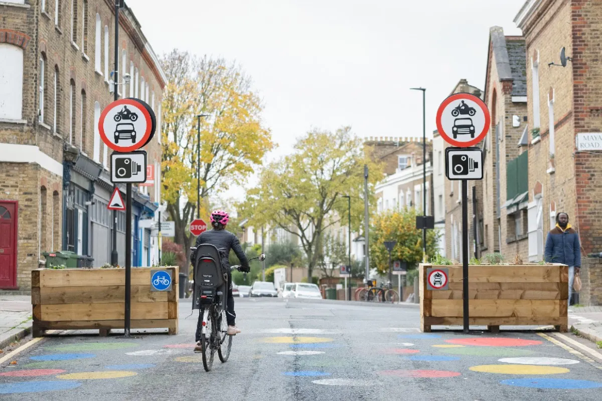
When COVID-19 hit Britain local authorities were given the power to close roads to create “Low Traffic Neighbourhoods” (LTNs), without needing extensive consultations. Guarded by planters and enforced by CCTV, local roads were shut off for through traffic.
Despite vocal backlash, this didn’t translate to residents expressing their anger at the ballot box in local elections. For this reason, The Centre for London think-tank believes that councils will now be emboldened to roll out more LTNs, describing the issue as “the dog that didn’t bark”.
While exemptions are granted for Emergency Services, the standard GPS navigation apps we have all become so reliant on aren’t designed to take those exemptions into account. As a result, first responders find themselves inadvertently going the long way round.
"The LAS [London Ambulance Service] has its own bespoke navigation system, but I’m told it’s not entirely trusted, with drivers often using apps on their phones. Some LTNs have camera-enforced filters, through which emergency services can pass – but if a crew is relying on, say, Waze or Google Maps, they will not be directed that way."
Peter Walker, The Guardian
LTNs have been implemented in cities including London, Oxford, Bath and Birmingham. With additional funding allocated in 2022 to 19 local/combined authorities across Britain for feasibility studies into new ‘Mini-Holland’ schemes, including LTNs, the direction of travel is clear for our road network.
How can first responders maintain response times, despite current navigation solutions not accounting for their legal exemptions?
At Blue Light Maps, we understand the challenges that emergency services face in this new era of urban planning. That’s why we’ve developed a solution that is tailored to the specific needs of police, ambulance and fire services. Our technology is designed to be fast, reliable, and easy to use, ensuring that emergency services can navigate to scene quickly and efficiently.
Don’t let the likes of LTNs, bus gates and turn restrictions impact your emergency response. Get in touch to find out more.
)
)
