Cadcorp SIS 9.1 further expands spatial analysis capabilities in latest Service Release
Spatial analysis operations for crime analysis
A range of new process operations and spatial statistics tools for
identifying and analysing patterns and trends in crime data have been added to
SIS Desktop.
‘Spatial Mean’ calculates the geographic centre of a set of points, for
example, locations of crime. This includes a ‘Weighted Spatial Mean’ option, enabling
analysts to target specific incident types.
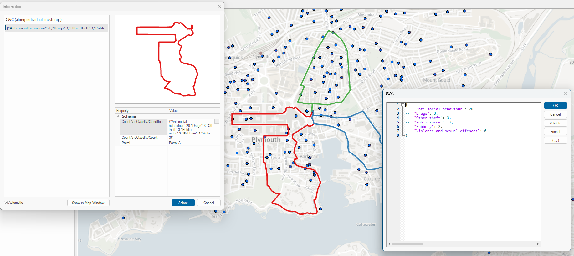
New ‘Count and Classify’ options include ‘along linear network’ to
assign an incident to the nearest part of the road network, and ‘along
individual linestrings’ to count incidents within a defined distance.
‘Nearest Neighbour Index’ counts a set of data points, from
items or from within polygons, and determines if these points are randomly
distributed or spatially clustered.
For resource and intervention targeting, ‘Location Quotient’ can
be used to analyse incidents, eg crimes, relative to population size. This is
useful for identifying which locations have a higher or lower than average
crime rate. The ‘Density-based spatial clustering of applications with noise’ (DBSCAN)
algorithm is also included, enabling analysts to create a cluster point, set a
cluster label property, and cluster items.
Additional routing options have been added to allow users to select a set of start points and a 'cost’, in time or length. From each of these points, an isochrone is created, showing how far a vehicle can travel using the road network.
Latest OS NGD feature types supported
Cadcorp is an Ordnance Survey Premium Partner and continues to provide in-software support for the latest OS NGD data enhancements. This includes the new Building Access Location, Crowd Sourced Name Point, and Street Light feature types released in March 2025.
what3words integration in SIS Desktop
SIS Desktop search now supports what3words. Once a customer has
added their what3words
API key, they
can search a what3words address or click on the map to learn the what3words
address for that location.
In addition to standard search, a range of further options have
been added including what3words cursor-tracking displayed in the status bar. To
support analysts, what3words addresses can be bulk geocoded, and a grid
reference expression can return the what3words address as a dynamic attribute. what3words
has also been added to ‘View Geometry’, allowing users to take, for example, a
spreadsheet or database table containing what3words addresses and display the
locations in SIS Desktop as a map overlay.